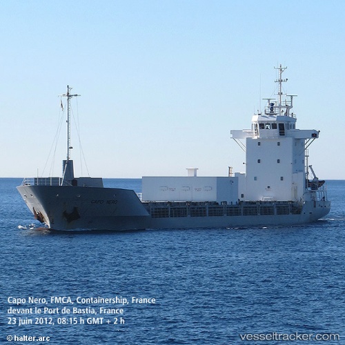
 Capo Nero
Current Status
Where is the vessel?
Capo Nero is currently in Near Ajaccio, based on AIS data received about 15h ago.
Latest AIS update:
Current position: 41.92418° N, 8.74067° E (Near Ajaccio)
Average speed (last 7 days): Loading…
Average speed (last 30 days): Loading…
Vessel profile: Capo Nero is a Cement Carrier with dimensions 90m x 13m.
This page combines live AIS, route history, probable destination signals, nearby traffic, and port activity for practical vessel monitoring.
The current position of vessel Capo Nero is 41.92418 lat / 8.74067 lng. Updated: 2026-05-20 13:47:32 UTCNearest reference points:
- Near Ajaccio
- Near Mezzavia
- Near Propriano
Currently sailing under the flag of France ![]()
Capo Nero built in 1997 year
Deadweight:
2800 tDetails:
Live Vessel Capo Nero Analytics (details, animations, etc.)
Recent AIS points (UTC):
2026-05-20 10:26:29 UTC · 41.92416, 8.74066 · SOG 0 kn · COG 91°2026-05-20 11:50:32 UTC · 41.92415, 8.74064 · SOG 0 kn · COG 90°
2026-05-20 13:26:29 UTC · 41.92419, 8.74062 · SOG 0 kn · COG 90°
2026-05-20 13:47:32 UTC · 41.92418, 8.74067 · SOG 0 kn · COG 90°