 Navalis
Current Status
Where is the vessel?
Navalis is currently in 29 nm SE of Soroosh (Cyrus) Terminal, based on AIS data received about 15h ago.
Latest AIS update:
Current position: 28.70217° N, 49.87930° E (29 nm SE of Soroosh (Cyrus) Terminal)
Average speed (last 7 days): Loading…
Average speed (last 30 days): Loading…
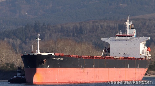
Vessel profile: Navalis is a Bulk Carrier with dimensions 225m x 225m.
This page combines live AIS, route history, probable destination signals, nearby traffic, and port activity for practical vessel monitoring.
The current position of vessel Navalis is 28.70217 lat / 49.87930 lng. Updated: 2026-05-21 06:00:05 UTCNearest reference points:
- 41 nm S of Soroosh (Cyrus) Terminal
- 38 nm S of Soroosh (Cyrus) Terminal
- 31 nm S of Soroosh (Cyrus) Terminal
Currently sailing under the flag of Panama ![]()
Navalis built in 1998 year
Deadweight:
73144 tDetails:
Live Vessel Navalis Analytics (details, animations, etc.)
Recent AIS points (UTC):
2026-05-21 01:44:19 UTC · 28.30737, 50.54869 · SOG 0.9 kn · COG -1°2026-05-21 03:55:17 UTC · 28.49118, 50.25754 · SOG 11.4 kn · COG -1°
2026-05-21 04:10:35 UTC · 28.51810, 50.21186 · SOG 11.4 kn · COG -1°
2026-05-21 06:00:05 UTC · 28.70217, 49.87930 · SOG 11.4 kn · COG -1°