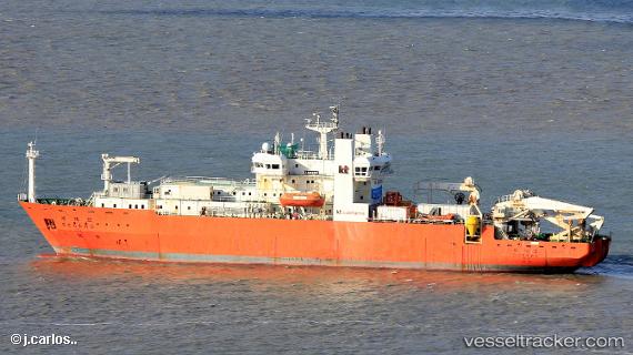
Segero
Current StatusWhere is the vessel?
Segero is currently in Near GOHYEON, based on AIS data received about 14h ago.
Latest AIS update:
Current position: 34.98026° N, 128.65710° E (Near GOHYEON)
Average speed (last 7 days): Loading…
Average speed (last 30 days): Loading…
Vessel profile: Segero is a Cable Layer with dimensions 20m x 114m.
This page combines live AIS, route history, probable destination signals, nearby traffic, and port activity for practical vessel monitoring.
The current position of vessel Segero is 34.98026 lat / 128.65710 lng. Updated: 2026-05-20 15:43:35 UTCNearest reference points:
- Near GOHYEON
- Near OKPO
- Near BUSAN NEW PORT
Details:
Live Vessel Segero Analytics (details, animations, etc.)
Recent AIS points (UTC):
2026-05-20 10:37:32 UTC · 34.98029, 128.65710 · SOG 0 kn · COG 305°2026-05-20 13:19:31 UTC · 34.98029, 128.65714 · SOG 0 kn · COG 305°
2026-05-20 13:55:32 UTC · 34.98030, 128.65710 · SOG 0 kn · COG 305°
2026-05-20 15:43:35 UTC · 34.98026, 128.65710 · SOG 0 kn · COG 305°