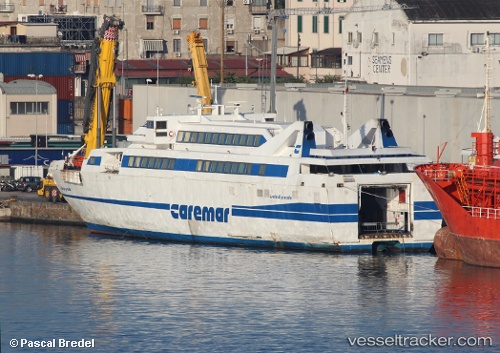
 Isola Di Procida
Current Status
Where is the vessel?
Isola Di Procida is currently in Near Naples, based on AIS data received about 14h ago.
Latest AIS update:
Current position: 40.83923° N, 14.29054° E (Near Naples)
Average speed (last 7 days): Loading…
Average speed (last 30 days): Loading…
Vessel profile: Isola Di Procida is a Passenger Ro Ro Cargo Ship with dimensions 71m x 12m.
This page combines live AIS, route history, probable destination signals, nearby traffic, and port activity for practical vessel monitoring.
The current position of vessel Isola Di Procida is 40.83923 lat / 14.29054 lng. Updated: 2026-05-19 04:15:36 UTCNearest reference points:
- Near Naples
- Near MERGELLINA
- Near Castellammare di Stabia
Currently sailing under the flag of Italy ![]()
Isola Di Procida built in 1999 year
Deadweight:
400 tDetails:
Live Vessel Isola Di Procida Analytics (details, animations, etc.)
Recent AIS points (UTC):
2026-05-19 01:22:56 UTC · 40.83921, 14.29058 · SOG 0 kn · COG -1°2026-05-19 01:49:55 UTC · 40.83921, 14.29062 · SOG 0 kn · COG -1°
2026-05-19 03:58:45 UTC · 40.83923, 14.29058 · SOG 0 kn · COG -1°
2026-05-19 04:15:36 UTC · 40.83923, 14.29054 · SOG 0 kn · COG -1°