 PRINCE CHARMING
Current Status
Where is the vessel?
PRINCE CHARMING is currently in 18 nm NW of Sha-lun, based on AIS data received about 14h ago.
Latest AIS update:
Current position: 25.35853° N, 121.05176° E (18 nm NW of Sha-lun)
Average speed (last 7 days): Loading…
Average speed (last 30 days): Loading…
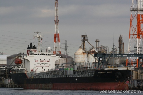
Vessel profile: PRINCE CHARMING is a Chemical/Oil Products Tanker with dimensions 112m x 19m.
This page combines live AIS, route history, probable destination signals, nearby traffic, and port activity for practical vessel monitoring.
The current position of vessel PRINCE CHARMING is 25.35853 lat / 121.05176 lng. Updated: 2026-05-20 01:42:55 UTCNearest reference points:
- Near Sha-lun
- Near Bali
- Near Hukou
Currently sailing under the flag of Panama ![]()
PRINCE CHARMING built in 1997 year
Deadweight:
8735 tDetails:
Live Vessel PRINCE CHARMING Analytics (details, animations, etc.)
Recent AIS points (UTC):
2026-05-19 21:44:28 UTC · 24.81791, 120.60485 · SOG 11.3 kn · COG -1°2026-05-20 00:14:55 UTC · 25.18706, 120.87995 · SOG 10.1 kn · COG 43°
2026-05-20 01:22:46 UTC · 25.32245, 121.01667 · SOG 8.3 kn · COG 43°
2026-05-20 01:42:55 UTC · 25.35853, 121.05176 · SOG 8.8 kn · COG 44°