 Tanto Raya
Current Status
Where is the vessel?
Tanto Raya is currently in Near GRESIK, based on AIS data received about 14h ago.
Latest AIS update:
Current position: 7.09652° S, 112.66401° E (Near GRESIK)
Average speed (last 7 days): Loading…
Average speed (last 30 days): Loading…
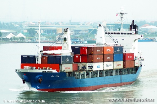
Vessel profile: Tanto Raya is a Container Ship with dimensions 120m x 20m.
This page combines live AIS, route history, probable destination signals, nearby traffic, and port activity for practical vessel monitoring.
The current position of vessel Tanto Raya is -7.09652 lat / 112.66401 lng. Updated: 2026-06-13 10:59:33 UTCNearest reference points:
- Near GRESIK
- Near Gresik, Java
- Near Bangkalan
Currently sailing under the flag of Indonesia ![]()
Tanto Raya built in 1998 year
Deadweight:
9114 tDetails:
Live Vessel Tanto Raya Analytics (details, animations, etc.)
Recent AIS points (UTC):
2026-06-13 07:17:33 UTC · -7.09645, 112.66421 · SOG 0.1 kn · COG 350°2026-06-13 07:23:28 UTC · -7.09647, 112.66403 · SOG 0.1 kn · COG 356°
2026-06-13 09:52:21 UTC · -7.09649, 112.66399 · SOG 0 kn · COG 2°
2026-06-13 10:59:33 UTC · -7.09652, 112.66401 · SOG 0 kn · COG 1°