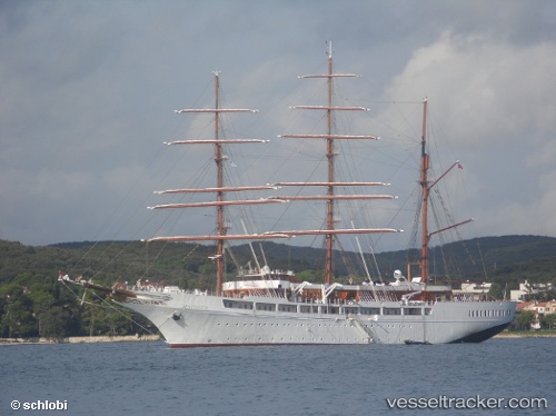
 Sea Cloud Ii
Current Status
Where is the vessel?
Sea Cloud Ii is currently in Near Giardini Naxos, based on AIS data received about 14h ago.
Latest AIS update:
Current position: 37.77903° N, 15.40052° E (Near Giardini Naxos)
Average speed (last 7 days): Loading…
Average speed (last 30 days): Loading…
Vessel profile: Sea Cloud Ii is a Cruise Ship with dimensions 117m x 16m.
This page combines live AIS, route history, probable destination signals, nearby traffic, and port activity for practical vessel monitoring.
The current position of vessel Sea Cloud Ii is 37.77903 lat / 15.40052 lng. Updated: 2026-05-20 22:01:30 UTCNearest reference points:
- Near Riposto
- Near San Leo di Pellaro
- Near TREMESTIERI
Currently sailing under the flag of Malta ![]()
Sea Cloud Ii built in 2000 year
Deadweight:
379 tDetails:
Live Vessel Sea Cloud Ii Analytics (details, animations, etc.)
Recent AIS points (UTC):
2026-05-20 16:25:49 UTC · 37.83362, 15.27946 · SOG 0 kn · COG 61°2026-05-20 17:34:54 UTC · 37.83277, 15.28061 · SOG 0.1 kn · COG 1°
2026-05-20 18:58:52 UTC · 37.83290, 15.28092 · SOG 0 kn · COG 335°
2026-05-20 22:01:30 UTC · 37.77903, 15.40052 · SOG 6.5 kn · COG 173°