 vesseltracker.com
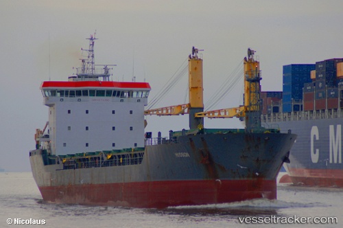
 IMMENSITY
Current Status
Where is the vessel?
IMMENSITY is currently in 23 nm N of VIESTE, based on AIS data received less than 1h ago.
Latest AIS update:
Current position: 42.25677° N, 16.27771° E (23 nm N of VIESTE)
Average speed (last 7 days): Loading…
Average speed (last 30 days): Loading…
Vessel profile: IMMENSITY is a General Cargo Ship with dimensions 108m x 18m.
This page combines live AIS, route history, probable destination signals, nearby traffic, and port activity for practical vessel monitoring.
The current position of vessel IMMENSITY is 42.25677 lat / 16.27771 lng. Updated: 2026-04-29 20:04:46 UTCNearest reference points:
- 26 nm N of Isole Tremiti
- Near Rogac
- Near Podglavica
Currently sailing under the flag of Panama ![]()
IMMENSITY built in 2002 year
Deadweight:
9766 tDetails:
Live Vessel IMMENSITY Analytics (details, animations, etc.)
Recent AIS points (UTC):
2026-04-29 16:10:17 UTC · 41.79288, 16.85822 · SOG 9.6 kn · COG 316°2026-04-29 18:00:36 UTC · 42.00962, 16.58745 · SOG 9.8 kn · COG 318°
2026-04-29 19:51:36 UTC · 42.23221, 16.31091 · SOG 9.6 kn · COG 314°
2026-04-29 20:04:46 UTC · 42.25677, 16.27771 · SOG 9.5 kn · COG 314°