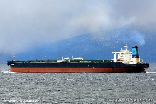
 IMPALAS
Current Status
Where is the vessel?
IMPALAS is currently in Near TANAH MERAH, based on AIS data received about 771d ago.
Latest AIS update:
Current position: 1.30630° N, 104.04925° E (Near TANAH MERAH)
Average speed (last 7 days): Loading…
Average speed (last 30 days): Loading…
Vessel profile: IMPALAS is a Crude Oil Tanker with dimensions 332m x 58m.
This page combines live AIS, route history, probable destination signals, nearby traffic, and port activity for practical vessel monitoring.
The current position of vessel IMPALAS is 1.30630 lat / 104.04925 lng. Updated: 2024-05-14 05:38:00 UTCNearest reference points:
- Near TANAH MERAH
- Near Changi
- Near Tanjung Setapa
Currently sailing under the flag of Panama ![]()
IMPALAS built in 1999 year
Deadweight:
299167 tDetails:
Live Vessel IMPALAS Analytics (details, animations, etc.)
Recent AIS points (UTC):
2024-05-14 05:38:00 UTC · 1.30630, 104.04925 · SOG 0.2 kn · COG 126° · DEST PJSB SG