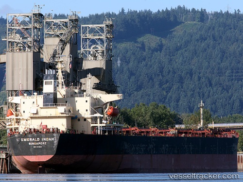
 EMERALD INDAH
Current Status
Where is the vessel?
EMERALD INDAH is currently in 12 nm NE of WEDA, based on AIS data received about 2d ago.
Latest AIS update:
Current position: 0.46967° N, 128.01468° E (12 nm NE of WEDA)
Average speed (last 7 days): Loading…
Average speed (last 30 days): Loading…
Vessel profile: EMERALD INDAH is a Bulk Carrier with dimensions m x m.
This page combines live AIS, route history, probable destination signals, nearby traffic, and port activity for practical vessel monitoring.
The current position of vessel EMERALD INDAH is 0.46967 lat / 128.01468 lng. Updated: 2026-05-19 12:45:11 UTCNearest reference points:
- 13 nm NE of WEDA
- Near TERNATE
- 55 nm S of Labuha, Molucas
Currently sailing under the flag of Indonesia ![]()
Details:
Live Vessel EMERALD INDAH Analytics (details, animations, etc.)
Recent AIS points (UTC):
2026-05-19 12:45:11 UTC · 0.46967, 128.01468 · SOG 0.1 kn · COG 279°2026-05-19 12:45:11 UTC · 0.46967, 128.01468 · SOG 0.1 kn · COG 279°
2026-05-19 12:45:11 UTC · 0.46967, 128.01468 · SOG 0.1 kn · COG 279°
2026-05-19 12:45:11 UTC · 0.46967, 128.01468 · SOG 0.1 kn · COG 279°