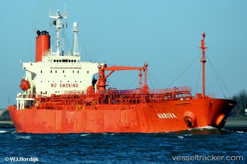
 Nariva
Current Status
Where is the vessel?
Nariva is currently in 24 nm NE of KIJANG, based on AIS data received about 15h ago.
Latest AIS update:
Current position: 1.15500° N, 104.86666° E (24 nm NE of KIJANG)
Average speed (last 7 days): Loading…
Average speed (last 30 days): Loading…
Vessel profile: Nariva is a Chemical Oil Products Tanker with dimensions 171m x 171m.
This page combines live AIS, route history, probable destination signals, nearby traffic, and port activity for practical vessel monitoring.
The current position of vessel Nariva is 1.15500 lat / 104.86666 lng. Updated: 2026-05-24 23:50:46 UTCNearest reference points:
- 38 nm E of PENGERANG
- 34 nm NE of PENGERANG
- 47 nm NE of PENGERANG
Currently sailing under the flag of Indonesia ![]()
Nariva built in 1998 year
Deadweight:
30977 tDetails:
Live Vessel Nariva Analytics (details, animations, etc.)
Recent AIS points (UTC):
2026-05-24 19:47:32 UTC · 0.64655, 105.25185 · SOG 9.5 kn · COG 332°2026-05-24 21:21:42 UTC · 0.85982, 105.12282 · SOG 9.4 kn · COG 332°
2026-05-24 22:38:21 UTC · 1.03758, 105.01705 · SOG 9.7 kn · COG 330°
2026-05-24 23:50:46 UTC · 1.15500, 104.86666 · SOG 9 kn · COG -1°