 vesseltracker.com
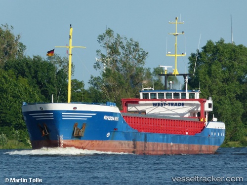
 Rhodanus
Current Status
Where is the vessel?
Rhodanus is currently in Near Jorf Lasfar, based on AIS data received about 1h ago.
Latest AIS update:
Current position: 33.14333° N, 8.67666° W (Near Jorf Lasfar)
Average speed (last 7 days): Loading…
Average speed (last 30 days): Loading…
Vessel profile: Rhodanus is a General Cargo Ship with dimensions 89m x 12m.
This page combines live AIS, route history, probable destination signals, nearby traffic, and port activity for practical vessel monitoring.
The current position of vessel Rhodanus is 33.14333 lat / -8.67666 lng. Updated: 2026-05-14 07:21:44 UTCNearest reference points:
- Near Jorf Lasfar
- 21 nm NW of El Jadida
- 44 nm NW of El Jadida
Currently sailing under the flag of Antigua Barbuda ![]()
Rhodanus built in 1998 year
Deadweight:
2953 tDetails:
Live Vessel Rhodanus Analytics (details, animations, etc.)
Recent AIS points (UTC):
2026-05-14 04:12:43 UTC · 33.14500, -8.67666 · SOG 0 kn · COG -1°2026-05-14 06:12:43 UTC · 33.14500, -8.67666 · SOG 0 kn · COG -1°
2026-05-14 06:51:44 UTC · 33.14333, -8.67666 · SOG 0 kn · COG -1°
2026-05-14 07:21:44 UTC · 33.14333, -8.67666 · SOG 0 kn · COG -1°