 vesseltracker.com
 KAURI
KAURI
Current Status
Where is the vessel?
KAURI is currently in 17 nm W of Korsnäs, based on AIS data received about 1h ago.
Latest AIS update:
Current position: 62.88229° N, 20.61413° E (17 nm W of Korsnäs)
Average speed (last 7 days): Loading…
Average speed (last 30 days): Loading…
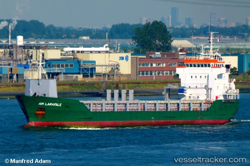
Vessel profile: KAURI is a General Cargo with dimensions 106m x 14m.
This page combines live AIS, route history, probable destination signals, nearby traffic, and port activity for practical vessel monitoring.
The current position of vessel KAURI is 62.88229 lat / 20.61413 lng. Updated: 2026-04-30 11:36:28 UTCNearest reference points:
- 20 nm S of HOLMSUND
- Near Finström
- Near Rouhu
Currently sailing under the flag of Antigua Barbuda ![]()
KAURI built in 1998 year
Deadweight:
4951 tDetails:
ex Am Larafale
ex MMSI: 248738000
Live Vessel KAURI Analytics (details, animations, etc.)
Recent AIS points (UTC):
2026-04-30 07:47:27 UTC · 63.08443, 21.55710 · SOG 0 kn · COG 124°2026-04-30 10:13:37 UTC · 63.17713, 20.68773 · SOG 12.9 kn · COG 218°
2026-04-30 10:52:06 UTC · 63.04431, 20.62275 · SOG 13.3 kn · COG 181°
2026-04-30 11:36:28 UTC · 62.88229, 20.61413 · SOG 13.2 kn · COG 176°