Anna T
Current StatusWhere is the vessel?
Anna T is currently in 14 nm N of Haines, based on AIS data received about 16h ago.
Latest AIS update:
Current position: 59.45147° N, 135.32503° W (14 nm N of Haines)
Average speed (last 7 days): Loading…
Average speed (last 30 days): Loading…
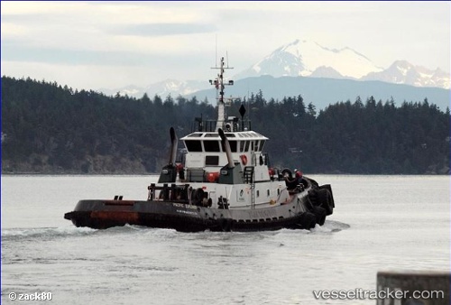
Vessel profile: Anna T is a Tug with dimensions 13m x 33m.
This page combines live AIS, route history, probable destination signals, nearby traffic, and port activity for practical vessel monitoring.
The current position of vessel Anna T is 59.45147 lat / -135.32503 lng. Updated: 2026-05-20 07:56:16 UTCNearest reference points:
- Near Juneau
- Near Sitka
Details:
Live Vessel Anna T Analytics (details, animations, etc.)
Recent AIS points (UTC):
2026-05-20 04:17:13 UTC · 59.45149, -135.32504 · SOG 0 kn · COG 222°2026-05-20 06:35:13 UTC · 59.45143, -135.32503 · SOG 0 kn · COG 222°
2026-05-20 07:35:17 UTC · 59.45148, -135.32504 · SOG 0 kn · COG 221°
2026-05-20 07:56:16 UTC · 59.45147, -135.32503 · SOG 0 kn · COG 222°