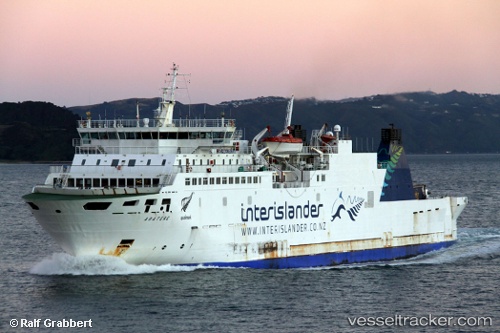
 VEGA
VEGA
Current Status
Where is the vessel?
VEGA is currently in Near Nelson, based on AIS data received about 14h ago.
Latest AIS update:
Current position: 41.15673° S, 173.27303° E (Near Nelson)
Average speed (last 7 days): Loading…
Average speed (last 30 days): Loading…
Vessel profile: VEGA is a Ro-Ro/Passenger Ship with dimensions m x m.
This page combines live AIS, route history, probable destination signals, nearby traffic, and port activity for practical vessel monitoring.
The current position of vessel VEGA is -41.15673 lat / 173.27303 lng. Updated: 2026-05-20 19:25:03 UTCNearest reference points:
- Near Nelson
- Near Renwick
- Near WAIKAWA
Currently sailing under the flag of Saint Kitts and Nevis ![]()
Details:
Live Vessel VEGA Analytics (details, animations, etc.)
Recent AIS points (UTC):
2026-05-20 15:35:05 UTC · -41.15667, 173.27333 · SOG 0 kn · COG -1°2026-05-20 16:02:09 UTC · -41.15667, 173.27333 · SOG 0 kn · COG -1°
2026-05-20 18:06:56 UTC · -41.15678, 173.27338 · SOG 0 kn · COG 269°
2026-05-20 19:25:03 UTC · -41.15673, 173.27303 · SOG 0 kn · COG 227°