 ZAMBRA
Current Status
Where is the vessel?
ZAMBRA is currently in 23 nm N of Port Said, based on AIS data received about 14h ago.
Latest AIS update:
Current position: 31.63573° N, 32.21513° E (23 nm N of Port Said)
Average speed (last 7 days): Loading…
Average speed (last 30 days): Loading…
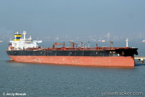
Vessel profile: ZAMBRA is a Crude Oil Tanker with dimensions m x m.
This page combines live AIS, route history, probable destination signals, nearby traffic, and port activity for practical vessel monitoring.
The current position of vessel ZAMBRA is 31.63573 lat / 32.21513 lng. Updated: 2026-05-19 23:43:52 UTCNearest reference points:
- 21 nm N of Port Said
- 16 nm N of Port Said
- 15 nm N of Port Said
Currently sailing under the flag of Cameroon ![]()
Details:
Live Vessel ZAMBRA Analytics (details, animations, etc.)
Recent AIS points (UTC):
2026-05-19 20:10:53 UTC · 31.63422, 32.21425 · SOG 0 kn · COG 329°2026-05-19 21:58:51 UTC · 31.63435, 32.21443 · SOG 0 kn · COG 318°
2026-05-19 22:31:51 UTC · 31.63455, 32.21485 · SOG 0.1 kn · COG 313°
2026-05-19 23:43:52 UTC · 31.63573, 32.21513 · SOG 0.1 kn · COG 280°