 vesseltracker.com
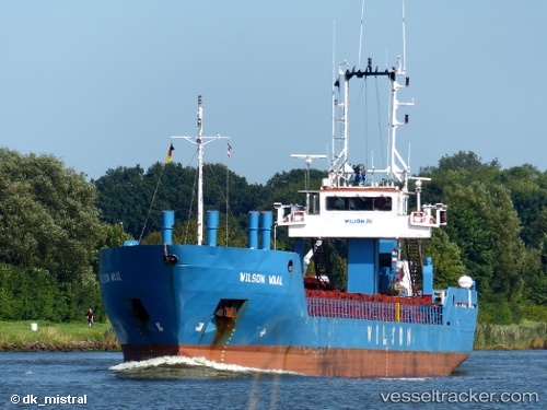
 Wilson Waal
Current Status
Where is the vessel?
Wilson Waal is currently in Near Keiss, based on AIS data received less than 1h ago.
Latest AIS update:
Current position: 58.48692° N, 3.09603° W (Near Keiss)
Average speed (last 7 days): Loading…
Average speed (last 30 days): Loading…
Vessel profile: Wilson Waal is a Multi Purpose Carrier with dimensions 78m x 10m.
This page combines live AIS, route history, probable destination signals, nearby traffic, and port activity for practical vessel monitoring.
The current position of vessel Wilson Waal is 58.48692 lat / -3.09603 lng. Updated: 2026-04-29 01:43:33 UTCNearest reference points:
- Near Staxigoe
- Near STROMNESS
- Near Tingwall
Currently sailing under the flag of Barbados ![]()
Wilson Waal built in 1999 year
Deadweight:
1836 tDetails:
Live Vessel Wilson Waal Analytics (details, animations, etc.)
Recent AIS points (UTC):
2026-04-28 21:31:16 UTC · 58.48701, -3.09606 · SOG 0 kn · COG 81°2026-04-28 22:27:55 UTC · 58.48716, -3.09601 · SOG 0 kn · COG 93°
2026-04-28 23:57:51 UTC · 58.48725, -3.09602 · SOG 0 kn · COG 105°
2026-04-29 01:43:33 UTC · 58.48692, -3.09603 · SOG 0 kn · COG 69°