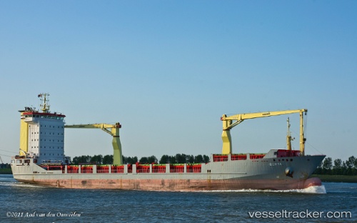
Olomana
Current StatusWhere is the vessel?
Olomana is currently in Near Auckland, based on AIS data received about 15h ago.
Latest AIS update:
Current position: 36.84333° S, 174.78104° E (Near Auckland)
Average speed (last 7 days): Loading…
Average speed (last 30 days): Loading…
Vessel profile: Olomana is a Multi Purpose Carrier with dimensions 18m x 118m.
This page combines live AIS, route history, probable destination signals, nearby traffic, and port activity for practical vessel monitoring.
The current position of vessel Olomana is -36.84333 lat / 174.78104 lng. Updated: 2026-05-25 04:02:33 UTCNearest reference points:
- Near WESTHAVEN
- Near ORAKEI
- Near Matiatia Bay
Details:
Live Vessel Olomana Analytics (details, animations, etc.)
Recent AIS points (UTC):
2026-05-24 23:32:32 UTC · -36.84333, 174.78104 · SOG 0 kn · COG 230°2026-05-25 01:20:33 UTC · -36.84358, 174.78098 · SOG 0 kn · COG 231°
2026-05-25 03:50:35 UTC · -36.84335, 174.78104 · SOG 0 kn · COG 229°
2026-05-25 04:02:33 UTC · -36.84333, 174.78104 · SOG 0 kn · COG 229°