 vesseltracker.com
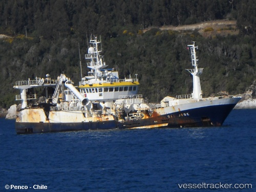
Vessel San Jose IMO: 9184407, MMSI: 725003670 Fishing Vessel
UTC, -35.25100, -72.67740, course: 286, speed: 5.7
UTC, -35.23250, -72.67811, course: 61, speed: 1
2026-02-15 21:33:12 UTC, -35.16975, -72.65390, course: 42, speed: 5
Live AIS position:
UTC. 15 nm NW of Constitución),
updated 2026-02-15 21:33:12 UTC.
Find the position of the vessel San Jose on the map. The latter are known coordinates and path.
marine traffic ship tracker show on live map
The current position of vessel San Jose is -35.16975 lat / -72.65390 lng. Updated: 2026-02-15 21:33:12 UTCDetails:
Last coordinates of the vessel:
UTC, -35.22090, -72.66621, course: 57, speed: 4.7UTC, -35.25100, -72.67740, course: 286, speed: 5.7
UTC, -35.23250, -72.67811, course: 61, speed: 1
2026-02-15 21:33:12 UTC, -35.16975, -72.65390, course: 42, speed: 5