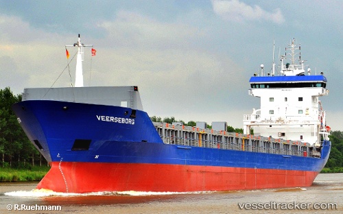
 Veerseborg
Current Status
Where is the vessel?
Veerseborg is currently in 27 nm SE of Los Ramos, based on AIS data received about 14h ago.
Latest AIS update:
Current position: 37.77967° N, 9.84330° W (27 nm SE of Los Ramos)
Average speed (last 7 days): Loading…
Average speed (last 30 days): Loading…
Vessel profile: Veerseborg is a Multi Purpose Carrier with dimensions 132m x 132m.
This page combines live AIS, route history, probable destination signals, nearby traffic, and port activity for practical vessel monitoring.
The current position of vessel Veerseborg is 37.77967 lat / -9.84330 lng. Updated: 2026-05-21 01:09:53 UTCNearest reference points:
- Near Sesimbra
- 54 nm W of Sagres
- Near CASCAIS
Currently sailing under the flag of St Kitts Nevis ![]()
Veerseborg built in 1998 year
Deadweight:
8736 tDetails:
Live Vessel Veerseborg Analytics (details, animations, etc.)
Recent AIS points (UTC):
2026-05-20 22:05:36 UTC · 38.32422, -10.01250 · SOG 11.6 kn · COG 164°2026-05-20 22:12:26 UTC · 38.30275, -10.00726 · SOG 11.6 kn · COG 165°
2026-05-21 00:15:43 UTC · 37.93545, -9.89818 · SOG 11.1 kn · COG 163°
2026-05-21 01:09:53 UTC · 37.77967, -9.84330 · SOG 10.6 kn · COG -1°