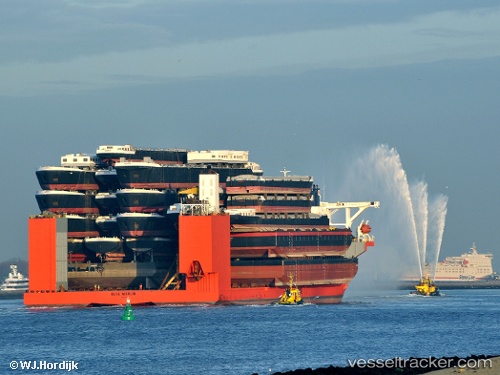
 BLUE MARLIN
Current Status
Where is the vessel?
BLUE MARLIN is currently in Near Freeport, based on AIS data received about 14h ago.
Latest AIS update:
Current position: 26.51926° N, 78.80489° W (Near Freeport)
Average speed (last 7 days): Loading…
Average speed (last 30 days): Loading…
Vessel profile: BLUE MARLIN is a Heavy Load Carrier with dimensions 225m x 63m.
This page combines live AIS, route history, probable destination signals, nearby traffic, and port activity for practical vessel monitoring.
The current position of vessel BLUE MARLIN is 26.51926 lat / -78.80489 lng. Updated: 2026-06-12 07:45:56 UTCNearest reference points:
- 44 nm S of Freeport
- 44 nm E of Surfside
- Near Palm Beach
Currently sailing under the flag of Malta ![]()
BLUE MARLIN built in 2000 year
Deadweight:
76061 tDetails:
Live Vessel BLUE MARLIN Analytics (details, animations, etc.)
Recent AIS points (UTC):
2026-06-12 05:03:56 UTC · 26.51895, -78.80509 · SOG 0 kn · COG 93°2026-06-12 05:27:56 UTC · 26.51901, -78.80509 · SOG 0 kn · COG 101°
2026-06-12 07:42:56 UTC · 26.51927, -78.80488 · SOG 0 kn · COG 135°
2026-06-12 07:45:56 UTC · 26.51926, -78.80489 · SOG 0 kn · COG 137°