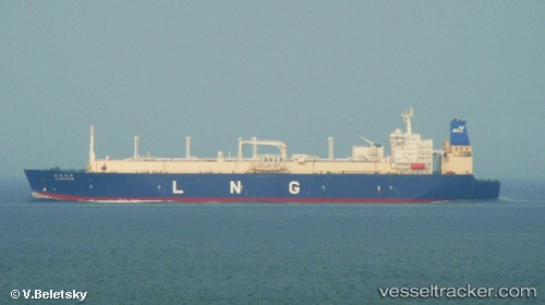
 K. FREESIA
Current Status
Where is the vessel?
K. FREESIA is currently in 58 nm N of Londolovit, based on AIS data received about 15h ago.
Latest AIS update:
Current position: 2.11781° S, 152.44241° E (58 nm N of Londolovit)
Average speed (last 7 days): Loading…
Average speed (last 30 days): Loading…
Vessel profile: K. FREESIA is a Lng Tanker with dimensions m x m.
This page combines live AIS, route history, probable destination signals, nearby traffic, and port activity for practical vessel monitoring.
The current position of vessel K. FREESIA is -2.11781 lat / 152.44241 lng. Updated: 2026-05-21 04:24:24 UTCNearest reference points:
- Near Rabaul
Currently sailing under the flag of Panama ![]()
Details:
Live Vessel K. FREESIA Analytics (details, animations, etc.)
Recent AIS points (UTC):
2026-05-21 01:17:32 UTC · -1.51106, 151.70441 · SOG 18.2 kn · COG 128°2026-05-21 01:34:01 UTC · -1.56285, 151.77089 · SOG 18.4 kn · COG 127°
2026-05-21 03:35:07 UTC · -1.96222, 152.24387 · SOG 18.3 kn · COG 129°
2026-05-21 04:24:24 UTC · -2.11781, 152.44241 · SOG 18.4 kn · COG 128°