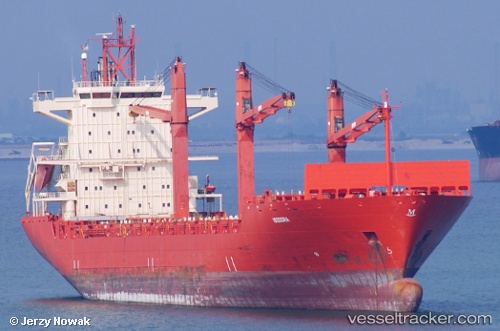
 SARAYU
Current Status
Where is the vessel?
SARAYU is currently in Near Dighi (Pune), based on AIS data received about 14h ago.
Latest AIS update:
Current position: 18.18709° N, 72.83733° E (Near Dighi (Pune))
Average speed (last 7 days): Loading…
Average speed (last 30 days): Loading…
Vessel profile: SARAYU is a Container Ship with dimensions m x m.
This page combines live AIS, route history, probable destination signals, nearby traffic, and port activity for practical vessel monitoring.
The current position of vessel SARAYU is 18.18709 lat / 72.83733 lng. Updated: 2026-05-20 11:04:06 UTCNearest reference points:
- Near Mumbai
- Near NHAVA SHEVA
- Near HNB SEZ/Mumbai
Currently sailing under the flag of India ![]()
Details:
Live Vessel SARAYU Analytics (details, animations, etc.)
Recent AIS points (UTC):
2026-05-20 06:35:27 UTC · 18.18624, 72.83651 · SOG 0 kn · COG 235°2026-05-20 08:43:17 UTC · 18.18624, 72.83652 · SOG 0 kn · COG 236°
2026-05-20 11:04:06 UTC · 18.18709, 72.83733 · SOG 0.6 kn · COG 231°
2026-05-20 11:04:06 UTC · 18.18709, 72.83733 · SOG 0.6 kn · COG 231°