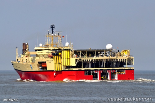
 RAMFORM VANGUARD
Current Status
Where is the vessel?
RAMFORM VANGUARD is currently in Near Colwyn Bay (Bae Colwyn), based on AIS data received about 14h ago.
Latest AIS update:
Current position: 53.42796° N, 3.69557° W (Near Colwyn Bay (Bae Colwyn))
Average speed (last 7 days): Loading…
Average speed (last 30 days): Loading…
Vessel profile: RAMFORM VANGUARD is a Research/Survey Vessel with dimensions m x m.
This page combines live AIS, route history, probable destination signals, nearby traffic, and port activity for practical vessel monitoring.
The current position of vessel RAMFORM VANGUARD is 53.42796 lat / -3.69557 lng. Updated: 2026-06-27 12:05:41 UTCNearest reference points:
- Near Rhôs-on-Sea
- Near Conwy (Conway)
- Near LIVERPOOL ANCH
Currently sailing under the flag of Bahamas ![]()
Details:
Live Vessel RAMFORM VANGUARD Analytics (details, animations, etc.)
Recent AIS points (UTC):
2026-06-27 08:17:44 UTC · 53.46022, -3.70576 · SOG 4.6 kn · COG 199°2026-06-27 10:00:33 UTC · 53.46559, -3.69583 · SOG 5 kn · COG 30°
2026-06-27 10:29:51 UTC · 53.48275, -3.71434 · SOG 4.9 kn · COG 205°
2026-06-27 12:05:41 UTC · 53.42796, -3.69557 · SOG 4.7 kn · COG 14°