 LIBURNIA
Current Status
Where is the vessel?
LIBURNIA is currently in Near Rijeka, based on AIS data received about 14h ago.
Latest AIS update:
Current position: 45.32861° N, 14.42652° E (Near Rijeka)
Average speed (last 7 days): Loading…
Average speed (last 30 days): Loading…
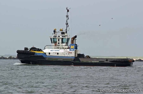
Vessel profile: LIBURNIA is a Tug with dimensions 11m x 31m.
This page combines live AIS, route history, probable destination signals, nearby traffic, and port activity for practical vessel monitoring.
The current position of vessel LIBURNIA is 45.32861 lat / 14.42652 lng. Updated: 2026-05-20 22:02:05 UTCNearest reference points:
- Near Rijeka
- Near VALBISKA
- Near Ankaran
Currently sailing under the flag of Croatia ![]()
LIBURNIA built in 2000 year
Deadweight:
175 tDetails:
Live Vessel LIBURNIA Analytics (details, animations, etc.)
Recent AIS points (UTC):
2026-05-20 16:24:55 UTC · 45.32861, 14.42651 · SOG 0.1 kn · COG 295°2026-05-20 17:38:45 UTC · 45.32861, 14.42648 · SOG 0.1 kn · COG 296°
2026-05-20 19:03:17 UTC · 45.32860, 14.42651 · SOG 0.1 kn · COG 295°
2026-05-20 22:02:05 UTC · 45.32861, 14.42652 · SOG 0 kn · COG 294°