Manantial
Current StatusWhere is the vessel?
Manantial is currently in Near Puerto Villamil, Isla Isabela, based on AIS data received about 182d ago.
Latest AIS update:
Current position: 0.96359° S, 90.96649° W (Near Puerto Villamil, Isla Isabela)
Average speed (last 7 days): Loading…
Average speed (last 30 days): Loading…
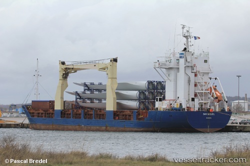
Vessel profile: Manantial is a Multi Purpose Carrier with dimensions 16m x 100m.
This page combines live AIS, route history, probable destination signals, nearby traffic, and port activity for practical vessel monitoring.
The current position of vessel Manantial is -0.96359 lat / -90.96649 lng. Updated: 2025-11-19 19:24:14 UTCNearest reference points:
- 12 nm SW of Puerto Villamil, Isla Isabela
- Near Puerto Ayora, Isla Santa Cruz
- Near Puerto Egas
Details:
Live Vessel Manantial Analytics (details, animations, etc.)
Recent AIS points (UTC):
2025-11-19 19:24:14 UTC · -0.96359, -90.96649 · SOG 0.1 kn · COG 166°