 Anouk
Anouk
Current Status
Where is the vessel?
Anouk is currently in Near Skolwin, based on AIS data received about 15h ago.
Latest AIS update:
Current position: 53.48130° N, 14.61410° E (Near Skolwin)
Average speed (last 7 days): Loading…
Average speed (last 30 days): Loading…
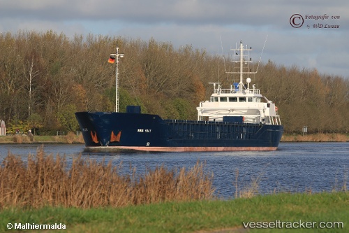
Vessel profile: Anouk is a Multi Purpose Carrier with dimensions 90m x 13m.
This page combines live AIS, route history, probable destination signals, nearby traffic, and port activity for practical vessel monitoring.
The current position of vessel Anouk is 53.4813 lat / 14.6141 lng. Updated: 2026-05-19 06:03:10 UTCNearest reference points:
- Near WOLGAST
- Near PEENEMUNDE
- Near KOLOBRZEG
Currently sailing under the flag of Germany ![]()
Anouk built in 2000 year
Deadweight:
3171 tDetails:
Live Vessel Anouk Analytics (details, animations, etc.)
Recent AIS points (UTC):
2026-05-19 01:50:01 UTC · 53.95290, 14.23750 · SOG 0.5 kn · COG 164°2026-05-19 03:56:44 UTC · 53.75750, 14.40680 · SOG 10 kn · COG 140°
2026-05-19 04:14:01 UTC · 53.71950, 14.45800 · SOG 10.1 kn · COG 141°
2026-05-19 06:03:10 UTC · 53.48130, 14.61410 · SOG 0.1 kn · COG 202°