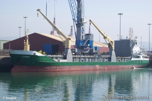
 CYGNUS
Current Status
Where is the vessel?
CYGNUS is currently in 40 nm N of PUERTO TARAFA, based on AIS data received about 15h ago.
Latest AIS update:
Current position: 22.20872° N, 77.44325° W (40 nm N of PUERTO TARAFA)
Average speed (last 7 days): Loading…
Average speed (last 30 days): Loading…
Vessel profile: CYGNUS is a General Cargo with dimensions m x m.
This page combines live AIS, route history, probable destination signals, nearby traffic, and port activity for practical vessel monitoring.
The current position of vessel CYGNUS is 22.20872 lat / -77.44325 lng. Updated: 2026-05-21 02:56:02 UTCNearest reference points:
- 36 nm E of Cayo Coco
- Near Great Exuma Island
- 16 nm SE of Ceiba Hueca
Currently sailing under the flag of Portugal ![]()
Details:
Live Vessel CYGNUS Analytics (details, animations, etc.)
Recent AIS points (UTC):
2026-05-21 00:50:18 UTC · 22.03433, -77.02198 · SOG 12.1 kn · COG 288°2026-05-21 02:19:15 UTC · 22.13314, -77.33875 · SOG 12.7 kn · COG 293°
2026-05-21 02:56:02 UTC · 22.20872, -77.44325 · SOG 12.2 kn · COG 311°
2026-05-21 02:56:02 UTC · 22.20872, -77.44325 · SOG 12.2 kn · COG 311°