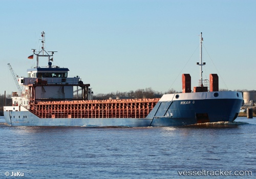
 Nikar G
Current Status
Where is the vessel?
Nikar G is currently in Near PORTBURY, based on AIS data received about 14h ago.
Latest AIS update:
Current position: 51.49836° N, 2.70536° W (Near PORTBURY)
Average speed (last 7 days): Loading…
Average speed (last 30 days): Loading…
Vessel profile: Nikar G is a Multi Purpose Carrier with dimensions 82m x 12m.
This page combines live AIS, route history, probable destination signals, nearby traffic, and port activity for practical vessel monitoring.
The current position of vessel Nikar G is 51.49836 lat / -2.70536 lng. Updated: 2026-06-13 07:58:47 UTCNearest reference points:
- Near PORTBURY
- Near Avonmouth
- Near Bird Port
Currently sailing under the flag of Antigua Barbuda ![]()
Nikar G built in 2000 year
Deadweight:
3154 tDetails:
Live Vessel Nikar G Analytics (details, animations, etc.)
Recent AIS points (UTC):
2026-06-13 04:37:45 UTC · 51.49835, -2.70535 · SOG 0 kn · COG 309°2026-06-13 05:43:47 UTC · 51.49837, -2.70533 · SOG 0 kn · COG 310°
2026-06-13 07:19:48 UTC · 51.49836, -2.70534 · SOG 0 kn · COG 309°
2026-06-13 07:58:47 UTC · 51.49836, -2.70536 · SOG 0 kn · COG 310°