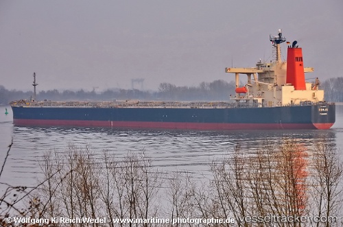
Sunny Boke
Current StatusWhere is the vessel?
Sunny Boke is currently in 11 nm N of Colomadu, based on AIS data received about 1d ago.
Latest AIS update:
Current position: 7.71745° N, 110.71811° E (11 nm N of Colomadu)
Average speed (last 7 days): Loading…
Average speed (last 30 days): Loading…
Vessel profile: Sunny Boke is a Bulk Carrier with dimensions 45m x 289m.
This page combines live AIS, route history, probable destination signals, nearby traffic, and port activity for practical vessel monitoring.
The current position of vessel Sunny Boke is 7.71745 lat / 110.71811 lng. Updated: 2026-06-13 00:37:06 UTCNearest reference points:
- 41 nm NW of Brebes
- 30 nm SW of Dai Hung (Tandem Load)
- 156 nm SE of Phan Rang-Tháp Chàm
Details:
Live Vessel Sunny Boke Analytics (details, animations, etc.)
Recent AIS points (UTC):
2026-06-13 00:37:06 UTC · 7.71745, 110.71811 · SOG 12.8 kn · COG 209°2026-06-13 00:37:06 UTC · 7.71745, 110.71811 · SOG 12.8 kn · COG 209°
2026-06-13 00:37:06 UTC · 7.71745, 110.71811 · SOG 12.8 kn · COG 209°
2026-06-13 00:37:06 UTC · 7.71745, 110.71811 · SOG 12.8 kn · COG 209°