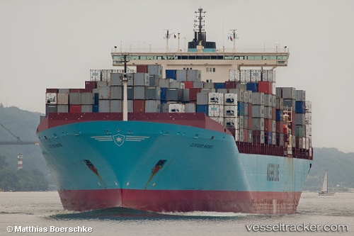
Clifford Maersk
Current StatusWhere is the vessel?
Clifford Maersk is currently in 324 nm N of Manihiki Island, based on AIS data received about 14h ago.
Latest AIS update:
Current position: 5.24812° S, 162.72269° W (324 nm N of Manihiki Island)
Average speed (last 7 days): Loading…
Average speed (last 30 days): Loading…
Vessel profile: Clifford Maersk is a Container Ship with dimensions 42m x 347m.
This page combines live AIS, route history, probable destination signals, nearby traffic, and port activity for practical vessel monitoring.
The current position of vessel Clifford Maersk is -5.24812 lat / -162.72269 lng. Updated: 2026-05-20 01:28:38 UTCDetails:
Live Vessel Clifford Maersk Analytics (details, animations, etc.)
Recent AIS points (UTC):
2026-05-19 22:06:07 UTC · -5.57241, -161.74217 · SOG 18.2 kn · COG 290°2026-05-19 23:37:03 UTC · -5.42711, -162.18434 · SOG 18.4 kn · COG 289°
2026-05-20 01:03:20 UTC · -5.29070, -162.60239 · SOG 17.9 kn · COG 291°
2026-05-20 01:28:38 UTC · -5.24812, -162.72269 · SOG 18.1 kn · COG 291°