 NEPTUNE
Current Status
Where is the vessel?
NEPTUNE is currently in Near Tampines, based on AIS data received about 1333d ago.
Latest AIS update:
Current position: 1.27369° N, 103.95206° E (Near Tampines)
Average speed (last 7 days): Loading…
Average speed (last 30 days): Loading…
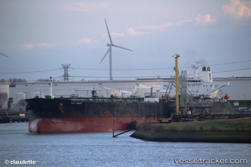
Vessel profile: NEPTUNE is a Crude Oil Tanker with dimensions 46m x 269m.
This page combines live AIS, route history, probable destination signals, nearby traffic, and port activity for practical vessel monitoring.
The current position of vessel NEPTUNE is 1.27369 lat / 103.95206 lng. Updated: 2022-10-21 08:54:26 UTCNearest reference points:
- Near Changi
- Near Tampines
- Near Choa Chu Kang
Currently sailing under the flag of Togo ![]()
NEPTUNE built in 2000 year
Deadweight:
152923 tDetails:
Live Vessel NEPTUNE Analytics (details, animations, etc.)
Recent AIS points (UTC):
2022-10-21 08:54:26 UTC · 1.27369, 103.95206 · SOG 0.1 kn · COG 63°