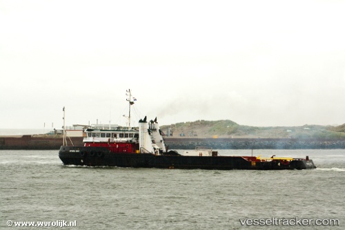
 Tenabo
Current Status
Where is the vessel?
Tenabo is currently in 13 nm NW of PUERTO PESQUERO, based on AIS data received about 5d ago.
Latest AIS update:
Current position: 18.76978° N, 92.02905° W (13 nm NW of PUERTO PESQUERO)
Average speed (last 7 days): Loading…
Average speed (last 30 days): Loading…
Vessel profile: Tenabo is a Offshore Tug Supply Ship with dimensions 61m x 12m.
This page combines live AIS, route history, probable destination signals, nearby traffic, and port activity for practical vessel monitoring.
The current position of vessel Tenabo is 18.76978 lat / -92.02905 lng. Updated: 2026-05-16 19:49:07 UTCNearest reference points:
- Near PUERTO PESQUERO
- 35 nm S of Yùum K'Ak'Náab
- 18 nm S of Yùum K'Ak'Náab
Currently sailing under the flag of Mexico ![]()
Tenabo built in 1998 year
Deadweight:
1226 tDetails:
Live Vessel Tenabo Analytics (details, animations, etc.)
Recent AIS points (UTC):
2026-05-16 19:49:07 UTC · 18.76978, -92.02905 · SOG 3.1 kn · COG 78°2026-05-16 19:49:07 UTC · 18.76978, -92.02905 · SOG 3.1 kn · COG 78°
2026-05-16 19:49:07 UTC · 18.76978, -92.02905 · SOG 3.1 kn · COG 78°
2026-05-16 19:49:07 UTC · 18.76978, -92.02905 · SOG 3.1 kn · COG 78°
2026-05-16 19:49:07 UTC · 18.76978, -92.02905 · SOG 3.1 kn · COG 78°