 Robris
Current Status
Where is the vessel?
Robris is currently in Near Alesund, based on AIS data received about 14h ago.
Latest AIS update:
Current position: 62.47269° N, 6.13452° E (Near Alesund)
Average speed (last 7 days): Loading…
Average speed (last 30 days): Loading…
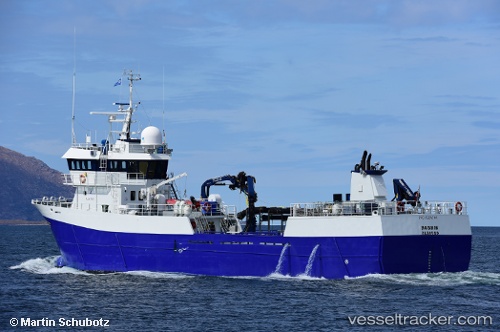
Vessel profile: Robris is a Fish Carrier with dimensions 46m x 10m.
This page combines live AIS, route history, probable destination signals, nearby traffic, and port activity for practical vessel monitoring.
The current position of vessel Robris is 62.47269 lat / 6.13452 lng. Updated: 2026-05-19 01:49:10 UTCNearest reference points:
- Near Alesund
- Near Gjøsundet
- Near Fiskarstrand
Currently sailing under the flag of Norway ![]()
Robris built in 1999 year
Deadweight:
500 tDetails:
Live Vessel Robris Analytics (details, animations, etc.)
Recent AIS points (UTC):
2026-05-18 22:58:14 UTC · 62.47271, 6.13452 · SOG 0 kn · COG 70°2026-05-19 00:03:50 UTC · 62.47270, 6.13449 · SOG 0 kn · COG 70°
2026-05-19 01:23:31 UTC · 62.47269, 6.13452 · SOG 0 kn · COG 69°
2026-05-19 01:49:10 UTC · 62.47269, 6.13452 · SOG 0 kn · COG 70°