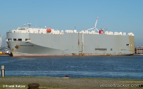
American Highway
Current StatusWhere is the vessel?
American Highway is currently in 98 nm N of Rashid, based on AIS data received about 15h ago.
Latest AIS update:
Current position: 33.00889° N, 30.07134° E (98 nm N of Rashid)
Average speed (last 7 days): Loading…
Average speed (last 30 days): Loading…
Vessel profile: American Highway is a Vehicles Carrier with dimensions 32m x 180m.
This page combines live AIS, route history, probable destination signals, nearby traffic, and port activity for practical vessel monitoring.
The current position of vessel American Highway is 33.00889 lat / 30.07134 lng. Updated: 2026-05-21 22:47:52 UTCNearest reference points:
- 129 nm NW of ABU QIR
- 108 nm S of Kastellorizou (ex Megísti)
- Near EL DEKHEILA
Details:
Live Vessel American Highway Analytics (details, animations, etc.)
Recent AIS points (UTC):
2026-05-21 18:31:24 UTC · 32.29629, 31.16156 · SOG 15.8 kn · COG 305°2026-05-21 19:33:38 UTC · 32.46594, 30.90002 · SOG 16.5 kn · COG 306°
2026-05-21 22:00:40 UTC · 32.87974, 30.26900 · SOG 16.1 kn · COG 307°
2026-05-21 22:47:52 UTC · 33.00889, 30.07134 · SOG 15.9 kn · COG 308°