 Autosky
Current Status
Where is the vessel?
Autosky is currently in Near RAMSGATE, based on AIS data received about 16h ago.
Latest AIS update:
Current position: 51.29610° N, 1.61059° E (Near RAMSGATE)
Average speed (last 7 days): Loading…
Average speed (last 30 days): Loading…
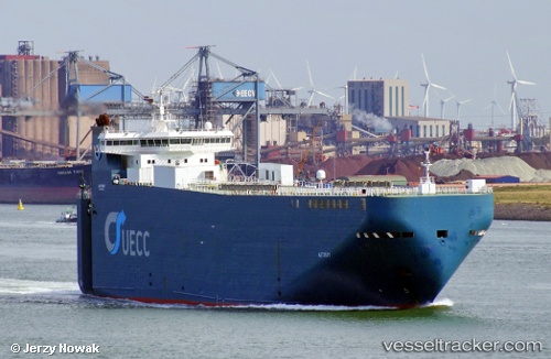
Vessel profile: Autosky is a Vehicles Carrier with dimensions 140m x 140m.
This page combines live AIS, route history, probable destination signals, nearby traffic, and port activity for practical vessel monitoring.
The current position of vessel Autosky is 51.29610 lat / 1.61059 lng. Updated: 2026-05-21 22:09:14 UTCNearest reference points:
- 14 nm SE of RAMSGATE
- Near RAMSGATE
- 15 nm E of RAMSGATE
Currently sailing under the flag of Portugal ![]()
Autosky built in 2000 year
Deadweight:
6670 tDetails:
Live Vessel Autosky Analytics (details, animations, etc.)
Recent AIS points (UTC):
2026-05-21 19:54:27 UTC · 50.99628, 1.51372 · SOG 9.9 kn · COG 43°2026-05-21 20:12:06 UTC · 51.03248, 1.56479 · SOG 9.7 kn · COG 43°
2026-05-21 21:53:57 UTC · 51.25993, 1.62105 · SOG 8 kn · COG 358°
2026-05-21 22:09:14 UTC · 51.29610, 1.61059 · SOG 9.7 kn · COG 352°