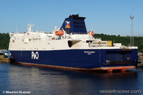
 European Causeway
Current Status
Where is the vessel?
European Causeway is currently in 10 nm W of Loch Ryan Pt, based on AIS data received about 15h ago.
Latest AIS update:
Current position: 54.99952° N, 5.32695° W (10 nm W of Loch Ryan Pt)
Average speed (last 7 days): Loading…
Average speed (last 30 days): Loading…
Vessel profile: European Causeway is a Passenger Ro Ro Cargo Ship with dimensions 145m x 24m.
This page combines live AIS, route history, probable destination signals, nearby traffic, and port activity for practical vessel monitoring.
The current position of vessel European Causeway is 54.99952 lat / -5.32695 lng. Updated: 2026-05-29 12:01:45 UTCNearest reference points:
- Near Southend
- Near Turnberry
- Near Shiskine
Currently sailing under the flag of Bahamas ![]()
European Causeway built in 2000 year
Deadweight:
4331 tDetails:
Live Vessel European Causeway Analytics (details, animations, etc.)
Recent AIS points (UTC):
2026-05-29 08:16:20 UTC · 55.01615, -5.19252 · SOG 16.3 kn · COG 59°2026-05-29 10:07:49 UTC · 54.96217, -5.01580 · SOG 0 kn · COG 300°
2026-05-29 10:52:49 UTC · 54.96216, -5.01581 · SOG 0 kn · COG 300°
2026-05-29 12:01:45 UTC · 54.99952, -5.32695 · SOG 17.5 kn · COG 245°