 SANTA BARBARA
Current Status
Where is the vessel?
SANTA BARBARA is currently in 50 nm SE of Abraham Bay, based on AIS data received about 21h ago.
Latest AIS update:
Current position: 21.69134° N, 72.47128° W (50 nm SE of Abraham Bay)
Average speed (last 7 days): Loading…
Average speed (last 30 days): Loading…
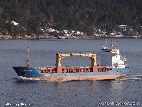
Vessel profile: SANTA BARBARA is a General Cargo with dimensions m x m.
This page combines live AIS, route history, probable destination signals, nearby traffic, and port activity for practical vessel monitoring.
The current position of vessel SANTA BARBARA is 21.69134 lat / -72.47128 lng. Updated: 2026-05-24 18:59:48 UTCNearest reference points:
- 47 nm SW of Cockburn Harbour
- 38 nm SW of Cockburn Harbour
- 56 nm SW of Cockburn Harbour
Currently sailing under the flag of Barbados ![]()
Details:
Live Vessel SANTA BARBARA Analytics (details, animations, etc.)
Recent AIS points (UTC):
2026-05-24 18:59:48 UTC · 21.69134, -72.47128 · SOG 0.1 kn · COG 100°2026-05-24 18:59:48 UTC · 21.69134, -72.47128 · SOG 0.1 kn · COG 100°
2026-05-24 18:59:48 UTC · 21.69134, -72.47128 · SOG 0.1 kn · COG 100°
2026-05-24 18:59:48 UTC · 21.69134, -72.47128 · SOG 0.1 kn · COG 100°