 vesseltracker.com
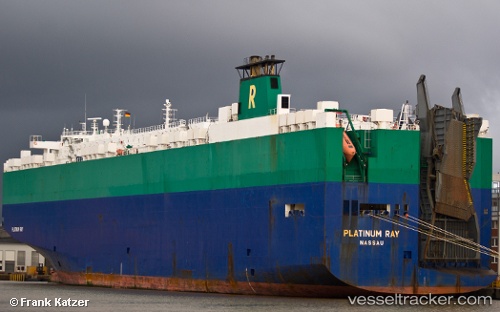
Platinum Ray
Current StatusWhere is the vessel?
Platinum Ray is currently in Near Tompkinsville, based on AIS data received about 15h ago.
Latest AIS update:
Current position: 40.66705° N, 74.07053° W (Near Tompkinsville)
Average speed (last 7 days): Loading…
Average speed (last 30 days): Loading…
Vessel profile: Platinum Ray is a Vehicles Carrier with dimensions 32m x 200m.
This page combines live AIS, route history, probable destination signals, nearby traffic, and port activity for practical vessel monitoring.
The current position of vessel Platinum Ray is 40.66705 lat / -74.07053 lng. Updated: 2026-05-18 07:04:08 UTCNearest reference points:
- Near Tompkinsville
- Near Brooklyn
- Near Maher Terminal
Details:
Live Vessel Platinum Ray Analytics (details, animations, etc.)
Recent AIS points (UTC):
2026-05-18 04:23:43 UTC · 40.52232, -74.00024 · SOG 14.1 kn · COG 298°2026-05-18 04:41:55 UTC · 40.58995, -74.03807 · SOG 14.7 kn · COG 343°
2026-05-18 06:04:12 UTC · 40.66703, -74.07054 · SOG 0 kn · COG 300°
2026-05-18 07:04:08 UTC · 40.66705, -74.07053 · SOG 0 kn · COG 299°