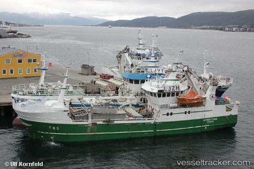
 Arnoytind
Current Status
Where is the vessel?
Arnoytind is currently in 57 nm N of Bjornoya, based on AIS data received about 14h ago.
Latest AIS update:
Current position: 75.44445° N, 19.43495° E (57 nm N of Bjornoya)
Average speed (last 7 days): Loading…
Average speed (last 30 days): Loading…
Vessel profile: Arnoytind is a Fishing Vessel with dimensions 37m x 37m.
This page combines live AIS, route history, probable destination signals, nearby traffic, and port activity for practical vessel monitoring.
The current position of vessel Arnoytind is 75.44445 lat / 19.43495 lng. Updated: 2026-06-17 01:22:32 UTCCurrently sailing under the flag of Norway ![]()
Arnoytind built in 2000 year
Deadweight:
200 tDetails:
Live Vessel Arnoytind Analytics (details, animations, etc.)
Recent AIS points (UTC):
2026-06-16 21:06:16 UTC · 75.42948, 19.34627 · SOG 0.1 kn · COG 80°2026-06-16 22:07:44 UTC · 75.42826, 19.34308 · SOG 0.4 kn · COG 80°
2026-06-16 23:57:45 UTC · 75.43480, 19.36355 · SOG 0.4 kn · COG 86°
2026-06-17 01:22:32 UTC · 75.44445, 19.43495 · SOG 1.7 kn · COG 14°