 vesseltracker.com
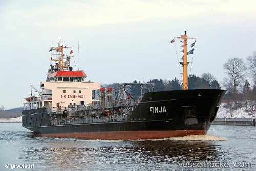
 Finja
Finja
Current Status
Where is the vessel?
Finja is currently in Near Bremerhaven, based on AIS data received less than 1h ago.
Latest AIS update:
Current position: 53.53007° N, 8.57615° E (Near Bremerhaven)
Average speed (last 7 days): Loading…
Average speed (last 30 days): Loading…
Vessel profile: Finja is a Chemical Oil Products Tanker with dimensions 68m x 12m.
This page combines live AIS, route history, probable destination signals, nearby traffic, and port activity for practical vessel monitoring.
The current position of vessel Finja is 53.53007 lat / 8.57615 lng. Updated: 2026-05-16 01:50:37 UTCNearest reference points:
- Near Bremerhaven
- Near Sandstedt
- Near Brake
Currently sailing under the flag of Germany ![]()
Finja built in 2000 year
Deadweight:
1335 tDetails:
Live Vessel Finja Analytics (details, animations, etc.)
Recent AIS points (UTC):
2026-05-15 22:12:00 UTC · 53.68828, 8.34821 · SOG 9.9 kn · COG 140°2026-05-15 23:46:31 UTC · 53.53246, 8.57832 · SOG 0 kn · COG 184°
2026-05-16 01:26:34 UTC · 53.53008, 8.57616 · SOG 0 kn · COG 193°
2026-05-16 01:50:37 UTC · 53.53007, 8.57615 · SOG 0 kn · COG 193°