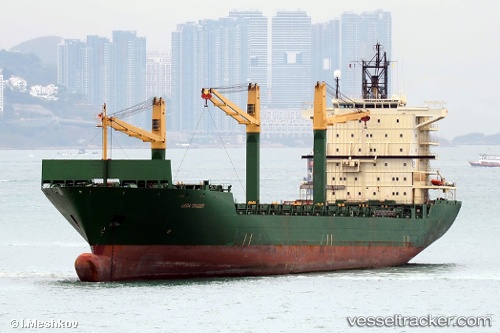
 MERATUS JAYAGIRI
Current Status
Where is the vessel?
MERATUS JAYAGIRI is currently in 217 nm SE of Wanning, based on AIS data received about 14h ago.
Latest AIS update:
Current position: 16.23397° N, 113.06408° E (217 nm SE of Wanning)
Average speed (last 7 days): Loading…
Average speed (last 30 days): Loading…
Vessel profile: MERATUS JAYAGIRI is a Container Ship with dimensions m x m.
This page combines live AIS, route history, probable destination signals, nearby traffic, and port activity for practical vessel monitoring.
The current position of vessel MERATUS JAYAGIRI is 16.23397 lat / 113.06408 lng. Updated: 2026-05-21 04:14:01 UTCNearest reference points:
- 215 nm NE of Tan Cang Qui Nhon
- 157 nm SE of Xincun
- 222 nm E of Tan Cang Qui Nhon
Currently sailing under the flag of Panama ![]()
Details:
Live Vessel MERATUS JAYAGIRI Analytics (details, animations, etc.)
Recent AIS points (UTC):
2026-05-21 01:54:00 UTC · 16.53188, 113.30075 · SOG 9.7 kn · COG 215°2026-05-21 02:29:07 UTC · 16.45667, 113.24167 · SOG 9 kn · COG -1°
2026-05-21 03:54:22 UTC · 16.27885, 113.09675 · SOG 10 kn · COG 214°
2026-05-21 04:14:01 UTC · 16.23397, 113.06408 · SOG 9.8 kn · COG 217°