 vesseltracker.com
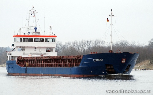
 Luhnau
Current Status
Where is the vessel?
Luhnau is currently in 21 nm E of Los Ramos, based on AIS data received less than 1h ago.
Latest AIS update:
Current position: 38.03333° N, 9.90333° W (21 nm E of Los Ramos)
Average speed (last 7 days): Loading…
Average speed (last 30 days): Loading…
Vessel profile: Luhnau is a Multi Purpose Carrier with dimensions 89m x 89m.
This page combines live AIS, route history, probable destination signals, nearby traffic, and port activity for practical vessel monitoring.
The current position of vessel Luhnau is 38.03333 lat / -9.90333 lng. Updated: 2026-05-13 19:37:07 UTCNearest reference points:
- 18 nm W of Colares
- Near CASCAIS
- Near Sesimbra
Currently sailing under the flag of Antigua Barbuda ![]()
Luhnau built in 2007 year
Deadweight:
3720 tDetails:
Live Vessel Luhnau Analytics (details, animations, etc.)
Recent AIS points (UTC):
2026-05-13 16:25:09 UTC · 38.55500, -10.05166 · SOG 9 kn · COG -1°2026-05-13 18:06:15 UTC · 38.28034, -9.97873 · SOG 10.1 kn · COG 166°
2026-05-13 18:58:08 UTC · 38.13833, -9.93500 · SOG 9 kn · COG -1°
2026-05-13 19:37:07 UTC · 38.03333, -9.90333 · SOG 9 kn · COG -1°