Da Jia
Current StatusWhere is the vessel?
Da Jia is currently in 15 nm SW of SHANWEI, based on AIS data received about 14h ago.
Latest AIS update:
Current position: 22.59050° N, 115.15512° E (15 nm SW of SHANWEI)
Average speed (last 7 days): Loading…
Average speed (last 30 days): Loading…
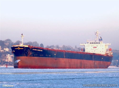
Vessel profile: Da Jia is a Bulk Carrier with dimensions 32m x 225m.
This page combines live AIS, route history, probable destination signals, nearby traffic, and port activity for practical vessel monitoring.
The current position of vessel Da Jia is 22.59050 lat / 115.15512 lng. Updated: 2026-05-21 04:03:46 UTCNearest reference points:
- 13 nm E of Bijia
- Near Pinghai
- Near SHANWEI
Details:
Live Vessel Da Jia Analytics (details, animations, etc.)
Recent AIS points (UTC):
2026-05-21 01:54:47 UTC · 22.59041, 115.15503 · SOG 0.2 kn · COG 295°2026-05-21 02:33:50 UTC · 22.59052, 115.15509 · SOG 0.1 kn · COG 290°
2026-05-21 03:48:49 UTC · 22.59053, 115.15512 · SOG 0.1 kn · COG 290°
2026-05-21 04:03:46 UTC · 22.59050, 115.15512 · SOG 0.1 kn · COG 291°