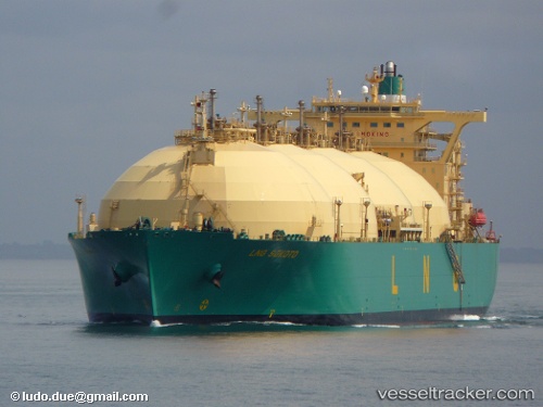
 Lng Sokoto
Current Status
Where is the vessel?
Lng Sokoto is currently in Open sea, approx. 401 nm off the nearest listed port, based on AIS data received about 14h ago.
Latest AIS update:
Current position: 11.81667° S, 56.35500° E (Open sea, approx. 401 nm off the nearest listed port)
Average speed (last 7 days): Loading…
Average speed (last 30 days): Loading…
Vessel profile: Lng Sokoto is a Lng Tanker with dimensions 288m x 48m.
This page combines live AIS, route history, probable destination signals, nearby traffic, and port activity for practical vessel monitoring.
The current position of vessel Lng Sokoto is -11.81667 lat / 56.35500 lng. Updated: 2026-06-17 13:50:02 UTCNearest reference points:
- Open sea, approx. 401 nm off the nearest listed port
- Open sea, approx. 402 nm off the nearest listed port
- Open sea, approx. 405 nm off the nearest listed port
Currently sailing under the flag of Bermuda ![]()
Lng Sokoto built in 2002 year
Deadweight:
79822 tDetails:
Live Vessel Lng Sokoto Analytics (details, animations, etc.)
Recent AIS points (UTC):
2026-06-17 09:31:59 UTC · -12.65833, 55.86333 · SOG 13 kn · COG -1°2026-06-17 10:10:58 UTC · -12.52833, 55.92833 · SOG 13 kn · COG -1°
2026-06-17 11:50:53 UTC · -12.19585, 56.11119 · SOG 13.8 kn · COG 36°
2026-06-17 13:50:02 UTC · -11.81667, 56.35500 · SOG 13 kn · COG -1°