 DE LI
DE LI
Current Status
Where is the vessel?
DE LI is currently in 45 nm N of Bartin, based on AIS data received about 18h ago.
Latest AIS update:
Current position: 42.43982° N, 32.21882° E (45 nm N of Bartin)
Average speed (last 7 days): Loading…
Average speed (last 30 days): Loading…
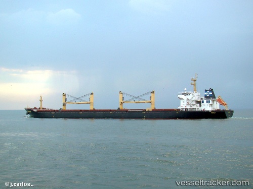
Vessel profile: DE LI is a Bulk Carrier with dimensions 189m x 32m.
This page combines live AIS, route history, probable destination signals, nearby traffic, and port activity for practical vessel monitoring.
The current position of vessel DE LI is 42.43982 lat / 32.21882 lng. Updated: 2026-05-20 11:49:26 UTCNearest reference points:
- Near Cide
- 27 nm NW of INEBOLU
- 18 nm NW of INEBOLU
Currently sailing under the flag of Panama ![]()
DE LI built in 2001 year
Deadweight:
49999 tDetails:
Live Vessel DE LI Analytics (details, animations, etc.)
Recent AIS points (UTC):
2026-05-20 11:49:26 UTC · 42.43982, 32.21882 · SOG 12.8 kn · COG 63°2026-05-20 11:49:26 UTC · 42.43982, 32.21882 · SOG 12.8 kn · COG 63°
2026-05-20 11:49:26 UTC · 42.43982, 32.21882 · SOG 12.8 kn · COG 63°
2026-05-20 11:49:26 UTC · 42.43982, 32.21882 · SOG 12.8 kn · COG 63°