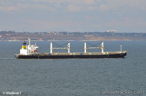
Papayiannis
Current StatusWhere is the vessel?
Papayiannis is currently in 24 nm NW of Dongtai, based on AIS data received about 8d ago.
Latest AIS update:
Current position: 33.06841° N, 119.91863° E (24 nm NW of Dongtai)
Average speed (last 7 days): Loading…
Average speed (last 30 days): Loading…
Vessel profile: Papayiannis is a Bulk Carrier with dimensions 32m x 190m.
This page combines live AIS, route history, probable destination signals, nearby traffic, and port activity for practical vessel monitoring.
The current position of vessel Papayiannis is 33.06841 lat / 119.91863 lng. Updated: 2026-06-23 09:03:42 UTCNearest reference points:
- 27 nm E of Baoying
- 23 nm E of Gaoyou
- 22 nm E of Gaoyou
Details:
Live Vessel Papayiannis Analytics (details, animations, etc.)
Recent AIS points (UTC):
2026-06-23 09:03:42 UTC · 33.06841, 119.91863 · SOG 8.3 kn · COG 157°2026-06-23 09:03:42 UTC · 33.06841, 119.91863 · SOG 8.3 kn · COG 157°
2026-06-23 09:03:42 UTC · 33.06841, 119.91863 · SOG 8.3 kn · COG 157°
2026-06-23 09:03:42 UTC · 33.06841, 119.91863 · SOG 8.3 kn · COG 157°