 Benavidez
Current Status
Where is the vessel?
Benavidez is currently in Near Gulfport, based on AIS data received about 15h ago.
Latest AIS update:
Current position: 30.35285° N, 89.09047° W (Near Gulfport)
Average speed (last 7 days): Loading…
Average speed (last 30 days): Loading…
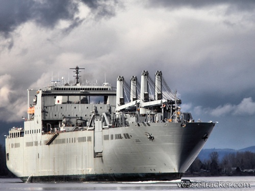
Vessel profile: Benavidez is a Vehicles Carrier with dimensions 289m x 32m.
This page combines live AIS, route history, probable destination signals, nearby traffic, and port activity for practical vessel monitoring.
The current position of vessel Benavidez is 30.35285 lat / -89.09047 lng. Updated: 2026-05-21 00:01:28 UTCNearest reference points:
- Near Diberville
- Near Ocean Springs
- Near Pascagoula
Currently sailing under the flag of USA ![]()
Benavidez built in 2003 year
Deadweight:
33721 tDetails:
Live Vessel Benavidez Analytics (details, animations, etc.)
Recent AIS points (UTC):
2026-05-20 19:05:43 UTC · 30.11830, -88.89268 · SOG 10.4 kn · COG 269°2026-05-20 21:51:03 UTC · 30.35292, -89.09036 · SOG 0.2 kn · COG 144°
2026-05-20 23:01:20 UTC · 30.35291, -89.09039 · SOG 0 kn · COG 146°
2026-05-21 00:01:28 UTC · 30.35285, -89.09047 · SOG 0 kn · COG 146°