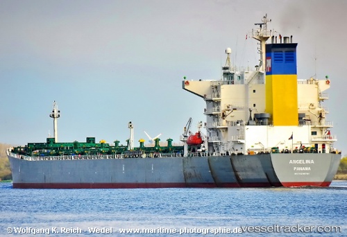
 Angelina
Current Status
Where is the vessel?
Angelina is currently in 86 nm E of KIJANG, based on AIS data received about 15h ago.
Latest AIS update:
Current position: 1.09500° N, 106.01833° E (86 nm E of KIJANG)
Average speed (last 7 days): Loading…
Average speed (last 30 days): Loading…
Vessel profile: Angelina is a Bulk Carrier with dimensions 225m x 32m.
This page combines live AIS, route history, probable destination signals, nearby traffic, and port activity for practical vessel monitoring.
The current position of vessel Angelina is 1.09500 lat / 106.01833 lng. Updated: 2026-05-21 00:00:19 UTCNearest reference points:
- 76 nm NE of KIJANG
- 47 nm NE of PENGERANG
- 38 nm E of PENGERANG
Currently sailing under the flag of Panama ![]()
Angelina built in 2001 year
Deadweight:
74540 tDetails:
Live Vessel Angelina Analytics (details, animations, etc.)
Recent AIS points (UTC):
2026-05-20 19:07:54 UTC · 0.12667, 105.78333 · SOG 12 kn · COG -1°2026-05-20 21:57:59 UTC · 0.69000, 105.93167 · SOG 12 kn · COG -1°
2026-05-20 22:18:17 UTC · 0.75815, 105.94772 · SOG 12.1 kn · COG 9°
2026-05-21 00:00:19 UTC · 1.09500, 106.01833 · SOG 12 kn · COG -1°