 Lincoln Sea
Current Status
Where is the vessel?
Lincoln Sea is currently in 109 nm S of Port Saint Joe, based on AIS data received about 14h ago.
Latest AIS update:
Current position: 28.04500° N, 85.80667° W (109 nm S of Port Saint Joe)
Average speed (last 7 days): Loading…
Average speed (last 30 days): Loading…
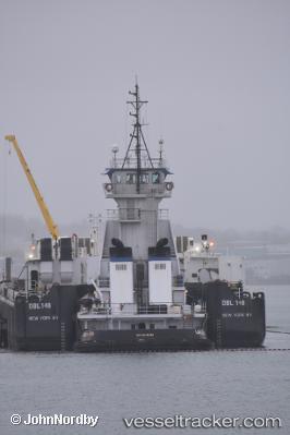
Vessel profile: Lincoln Sea is a Pusher Tug with dimensions 181m x 24m.
This page combines live AIS, route history, probable destination signals, nearby traffic, and port activity for practical vessel monitoring.
The current position of vessel Lincoln Sea is 28.04500 lat / -85.80667 lng. Updated: 2026-07-15 02:26:14 UTCNearest reference points:
- 58 nm SW of Suwannee
- Near Lynn Haven
- 62 nm SW of Anna Maria
Currently sailing under the flag of USA ![]()
Lincoln Sea built in 2000 year
Deadweight:
749 tDetails:
Live Vessel Lincoln Sea Analytics (details, animations, etc.)
Recent AIS points (UTC):
2026-07-14 23:53:12 UTC · 28.13167, -86.32833 · SOG 11 kn · COG -1°2026-07-15 00:11:14 UTC · 28.12333, -86.26667 · SOG 10 kn · COG -1°
2026-07-15 02:06:06 UTC · 28.05928, -85.87507 · SOG 10.8 kn · COG -1°
2026-07-15 02:26:14 UTC · 28.04500, -85.80667 · SOG 10 kn · COG -1°